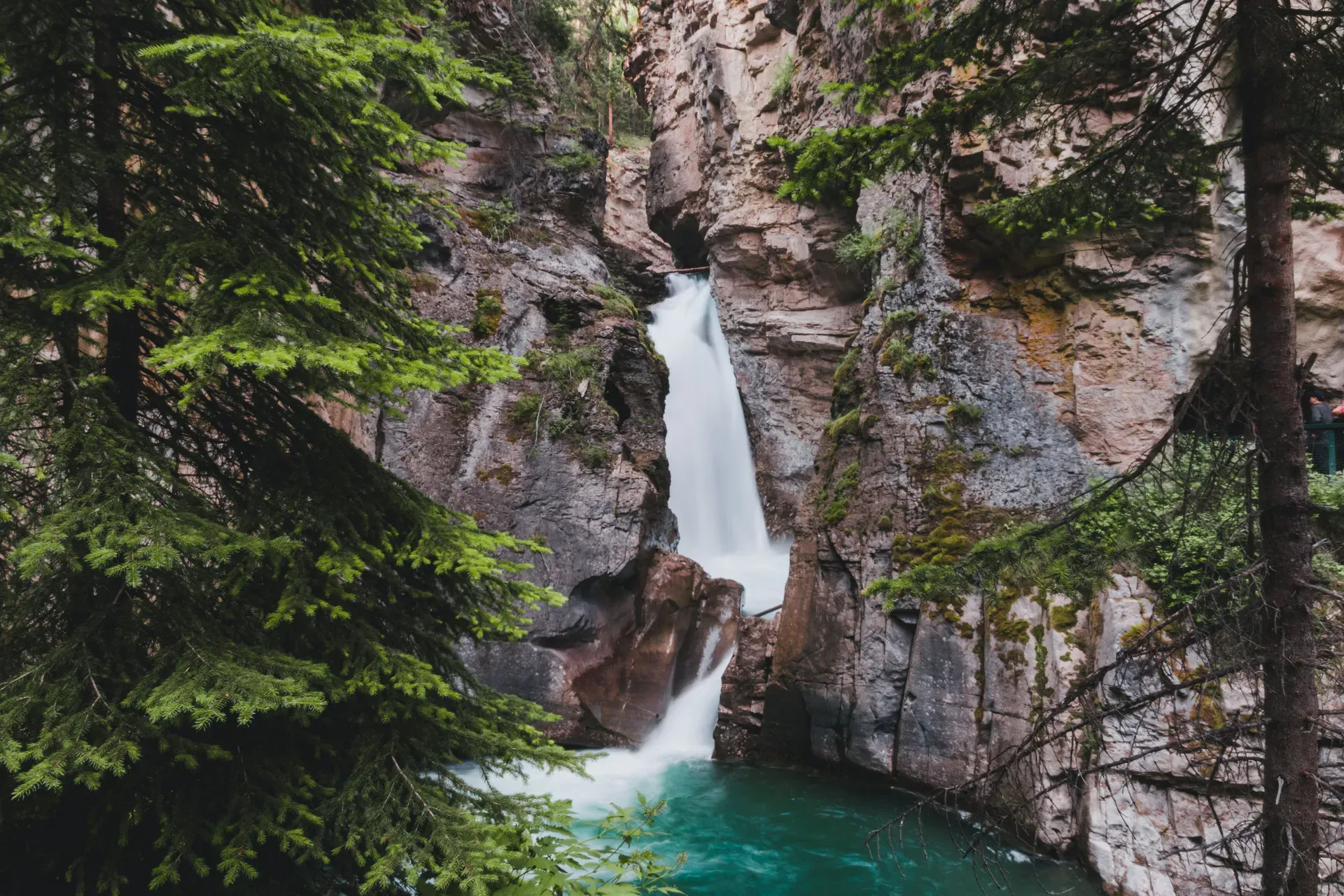
Suspended steel catwalks bolt directly into the limestone walls of Johnston Canyon, guiding hikers above the rushing waters of Johnston Creek. The deep mountain gorge features 30-meter waterfalls and 500-million-year-old rock formations just 25 kilometers west of Banff.
Suspended steel catwalks bolt directly into 500-million-year-old limestone, elevating hikers above the rushing turquoise waters of Johnston Creek. The canyon sits 25 kilometers west of the Banff townsite along the Bow Valley Parkway, cutting deeply into the Canadian Rockies. The gorge features sheer rock walls, deep plunge pools, and multiple cascading waterfalls. Visitors navigate the space via a network of paved paths and metal walkways engineered to cling to the cliff sides.
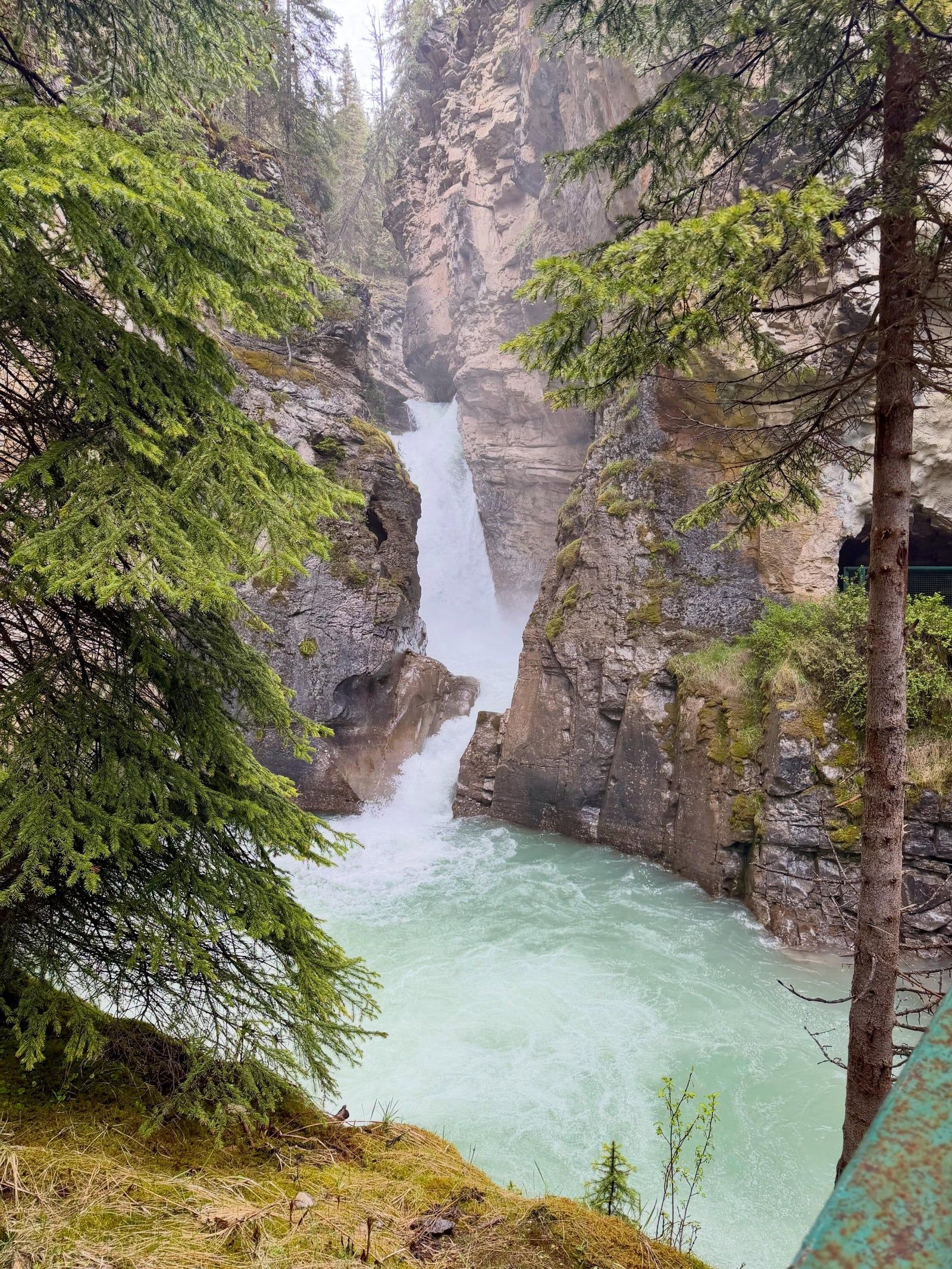
The spray hits your face 20 meters before you reach the Lower Falls. Hikers cross a wooden footbridge and pass through a natural rock tunnel to stand on a viewing platform just feet from the thundering water. Reaching the Upper Falls requires a steeper 2.5-kilometer trek, culminating in a 30-meter drop where water churns into a deep basin. Two distinct viewpoints allow you to look across at the bottom of the falls or stand on an overhanging platform to peer down into the gorge.
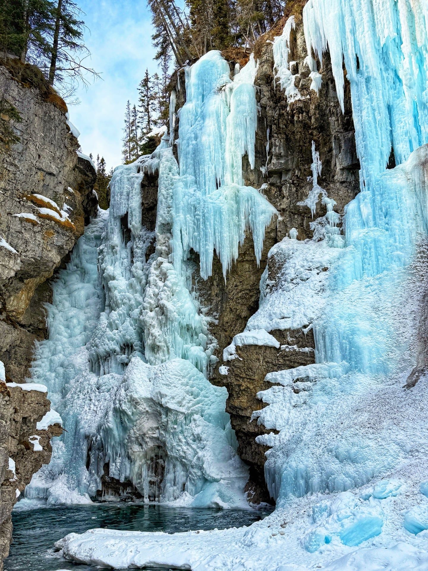
Extreme midday crowds pack the narrow catwalks between 10:00 AM and 3:00 PM during July and August. Parking lots fill to capacity early, forcing latecomers to turn around. Winter transforms the canyon into a corridor of frozen 30-meter ice pillars, drawing ice climbers who scale the Upper Falls. Hikers must wear microspikes from November through April to safely navigate the packed, slick ice on the suspended bridges. Arrive before 8:00 AM in summer to secure parking and walk the catwalks without elbowing through tour groups.
The trail starts in a dense lodgepole pine forest before narrowing into the canyon proper. The temperature drops noticeably the moment you step onto the steel grates suspended over the creek. Cold air sinks into the gorge, trapped by the overhanging rock formations. You hear the roar of the water long before you see the major falls, as the sound echoes off the tight limestone walls. Bring a light jacket even on 30-degree summer days, as the shaded interior rarely warms up.
A gold prospector named Johnston mapped this deep gorge in the 1880s. He failed to find any gold in the creek and eventually moved to British Columbia, leaving only his name behind. Tourism gained traction in the early 1900s as the Canadian Pacific Railway brought passengers to the Bow Valley. The first rudimentary trails and wooden bridges appeared during this era to accommodate the influx of train passengers seeking wilderness excursions. Hungarian prisoners from the Castle Mountain World War I internment camp constructed many of these early pathways under forced labor conditions. They felled local timber and built precarious wooden walkways that frequently washed away during spring floods.
Walter and Marguerite Camp established the Johnston Canyon Lodge and Bungalows at the trailhead in 1926. They built a series of rustic cabins and took over the maintenance of the canyon trails, charging early visitors a small toll for access. The couple expanded the site over decades, eventually constructing 42 family-owned cabins featuring wood-burning fireplaces. The lodge provided a basecamp for early mountaineers and tourists exploring the Banff wilderness by horseback and foot. Guests today still eat at the on-site BlackSwift Bistro after hiking the gorge, sleeping in modernized versions of the original 1920s structures.
Parks Canada acquired the trail system in the 1970s, eliminating the private toll and opening the canyon to the public. Engineers replaced the decaying wooden bridges with heavy-duty steel catwalks, bolting the metal frames directly into the solid limestone cliffs. This infrastructure allowed mass access while protecting the fragile canyon floor from human trampling. The trail requires constant maintenance due to freeze-thaw cycles that destabilize the rock faces and shear off metal bolts. Parks Canada occasionally closes the entire route for rockfall hazard management, such as the two-month shutdown scheduled to begin October 12, 2026. Crews will remove loose rock, scale the cliffs, and install heavy steel mesh safety systems to stabilize the towering walls. Check the official park bulletins before planning an autumn visit.
Water erosion from Johnston Creek carved this dramatic gorge into the bedrock over thousands of years. The towering walls consist of sedimentary limestone formed 300 to 500 million years ago during the Paleozoic Era. These rock layers contain the fossilized remains of ancient marine life, visible as small, textured ridges to those who know where to look. The landscape exhibits classic karst topography, characterized by dissolved limestone fissures, deep caves, and sudden sinkholes created by slightly acidic rainwater eating away at the alkaline rock.
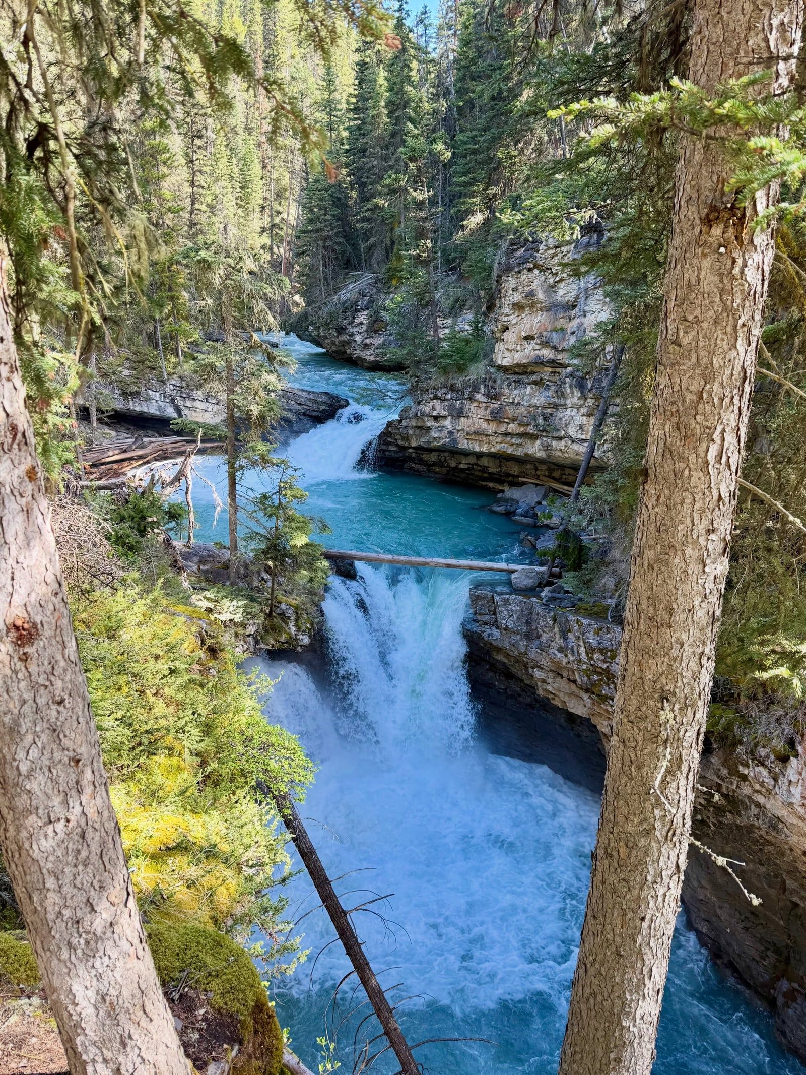
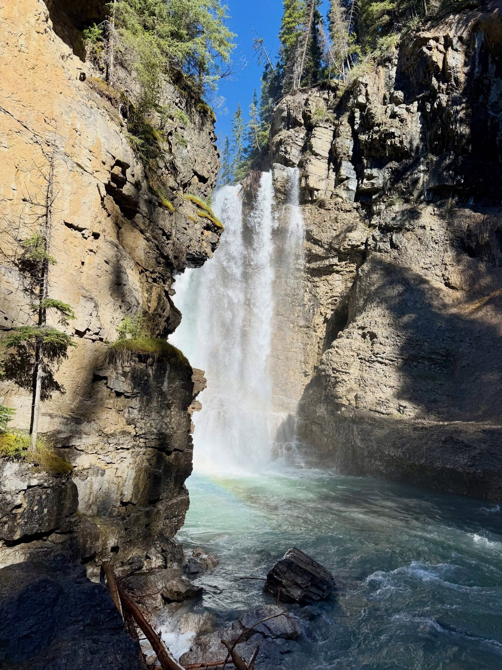
The Lower Falls drop 10 meters into a turbulent pool, accessible via a short natural tunnel eroded straight through the rock. Further upstream, the Upper Falls plunge 30 meters over a sheer limestone shelf. The water here takes on a distinct turquoise hue, a result of suspended glacial rock flour carried down from the mountains reflecting sunlight. An unmarked mini waterfall sits 15 minutes past the Lower Falls, reachable only by following a narrow dirt path over fallen trees to a secluded, mossy rock wall. The mist from these falls sustains a microclimate of thick green mosses and rare ferns that cling to the vertical surfaces.
Continuing 5.8 kilometers past the Upper Falls brings hikers to the Ink Pots. Seven mineral-rich pools bubble up from deep underground springs in a wide-open alpine meadow. The water in these pools maintains a constant temperature year-round, displaying distinct blue and green colors depending on the specific mineral concentration and fill rate of each basin. The slower-filling pools appear darker green, while the faster-filling ones look bright blue. Wooden benches line the meadow, offering a place to sit and observe the bubbling springs against the backdrop of the surrounding peaks. Pack extra water if you plan to hike this far, as the trail leaves the shaded canyon and climbs into exposed, sunny terrain.
The Bow Valley held deep significance for the Indigenous Stoney First Nations long before European prospectors arrived. They utilized the surrounding lands for hunting, gathering, and spiritual practices, respecting the canyon's natural resources and formidable terrain. The rushing waters and towering rock walls formed a natural barrier and a vital water source within the broader ecosystem of the Rockies. The deep caves and hidden fissures provided shelter during harsh winter storms that routinely sweep through the Bow Valley.
Today, the gorge functions as a highly protected ecological habitat. The steep, inaccessible limestone cliff walls provide a rare breeding ground for the endangered Black Swift bird. These migratory birds nest exclusively in the dark, damp crevices behind the waterfalls and along the sheer canyon walls. They rely on the constant mist to regulate the temperature of their single egg. Parks Canada actively enforces a strict off-trail ban between May 15 and November 15 to protect these nesting sites from human disturbance. Violators face fines of up to $25,000 CAD for stepping off the designated catwalks.
The site also represents a milestone in Canadian conservation and tourism engineering. The installation of suspended steel walkways demonstrated an early method of balancing mass visitation with environmental protection. The infrastructure keeps hundreds of thousands of annual visitors suspended above the fragile creek bed, preventing the total erosion of the canyon floor. This design model influenced trail construction in national parks across North America, proving that high-traffic areas could be managed without destroying the underlying ecosystem. Stay strictly on the metal grates to ensure this system continues to work.
The 500-million-year-old limestone walls contain fossilized remains of sea creatures from the Paleozoic Era.
Black Swifts nest exclusively in the damp, dark crevices of the canyon's steep cliff walls.
Leaving the designated catwalks during the Black Swift breeding season carries a penalty of up to $25,000 CAD.
The canyon is named after an 1880s prospector who mapped the gorge but never found any gold.
Hungarian World War I internment camp prisoners from Castle Mountain built the original wooden walkways.
The 30-meter Upper Falls freeze solid in winter, attracting ice climbers who scale the vertical blue pillars.
Seven mineral springs located past the falls constantly bubble cold water into colorful blue and green pools.
There is no specific fee to hike the trail, but visitors must purchase a Parks Canada Park Pass to enter Banff National Park. Daily passes cost $12.25 CAD for adults and $10.75 CAD for seniors.
The hike to the Lower Falls takes about one hour round trip, covering 2.4 kilometers. Reaching the Upper Falls requires a 5.0-kilometer round trip that typically takes two to three hours.
Roam Transit Route 9 operates daily direct service from the Banff High School Transit Hub between mid-May and October. The one-way fare costs $5.00 CAD for adults and the ride takes 35 minutes.
Dogs are permitted on the trail but must remain on a leash at all times. Owners must clean up after their pets and keep them on the paved pathways to protect local wildlife.
The trail remains open year-round and transforms into a frozen ice walk during the winter. Hikers must wear traction devices like microspikes or ice cleats to safely navigate the extremely slick, packed snow.
Recreational drone use is strictly prohibited in all Parks Canada national parks, including this canyon. Unauthorized drone flights can result in severe penalties and fines up to $25,000 CAD.
There are no public restrooms available anywhere along the trail to the falls or the Ink Pots. Visitors must use the heated facilities located at the main parking lot before starting their hike.
Travel is prohibited on the eastern 17-kilometer section of the parkway between 8:00 PM and 8:00 AM from May 1 to June 25. This restriction protects local wildlife during their most active hours.
Parks Canada will close the entire trail for two to three months starting October 12, 2026. Crews will perform routine rockfall hazard management to remove loose debris and stabilize the canyon walls.
The first 1.1 kilometers to the Lower Falls feature a paved path and flat steel catwalks suitable for wheelchairs and strollers. The route past the Lower Falls becomes steep and rugged, requiring travel on foot.
Browse verified tours with free cancellation and instant confirmation.
Find Tours